|
|
|
Air Traffic Control history in Canada is a fascinating study but I can only relate to the years from 1967-2002. As a new VFR controller all I knew about ATC in the North I had learned in Ottawa on Course 20 in 1966. In other words I knew very little about Goose Bay Labrador and even less about Frobisher Bay NWT. After I checked out IFR in 1969 in UL I met several controllers who had worked in Goose Bay and Frobisher Bay. Men like Garney Strahl, Ed LeSage, Don Parrish and Ray Landry to name a few. So for the majority of us, then and now, our knowledge is limited to stories the "old timers" have passed along.
One of the many pleasures of creating and maintaining this website is re-establishing contact with many of the fine controllers I have had the distinct pleasure of working with, and meeting new people and learning about their experiences. What follows is information about YFB from Ed LeSage, information about YYR from Ron Hay, and pictures of both places provided by Ron Hay.
Although YFB is at 63°45'N/68°33'W and YYR is at 53°19'/60°25', I would consider YYR to be in "the North". North is more relative to the distance from populous areas of the province or territory. I grew up in Flin Flon MB [54°46'N/101°51'W] which is considered North in Manitoba. We moved to Thompson MB [55°48'N/97°49'W] and I thought the people from Sudbury were funny; they considered Sudbury [46°37'N/80°48'W] or about 580 miles south, to be in Northern Ontario.  will take you to the top of the page will take you to the top of the page |
 ✦✦✦ Frobisher Bay ✦✦✦
 |
Iqaluit, the largest community in Nunavut as well as the capital city, is located in the southeast part of Baffin Island, at 63° 45' N., 68° 31' W. Formerly known as Frobisher Bay, it is at the mouth of the bay of that name, overlooking Koojesse Inlet. "Iqaluit" means 'place of many fish'. From Ed LeSage: During my time there (1960 to 1963) USAF/SAC had about 15 KC 97 tanker a/c stationed there. Their purpose was to refuel the B52s (if necessary) that patrolled the Arctic during the cold war. The USAF built that runway that long to accommodate the B52 in an emergency. The USAF also operated the Dew Line Radar site at Upper Base. When transatlantic jet flights began, Frobisher Bay was also used to service the Trans Polar jet a/c that used it as a refuelling stop for the short haul B707's and DC 8's. Once the long range B707's and DC8's were put in service YFB was bypassed by them. All this time Canada provided the ATC service and when the USAF/SAC moved in Canada just continued providing that service. |
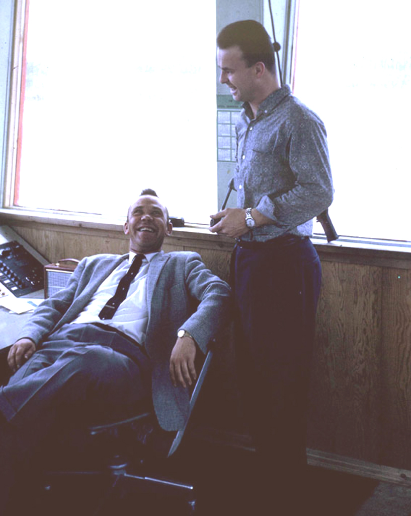
The "good old days" in Frobisher Tower in 1962. Garney Strahl and Ed LeSage enjoying a laugh. Note Ed's pipe! |
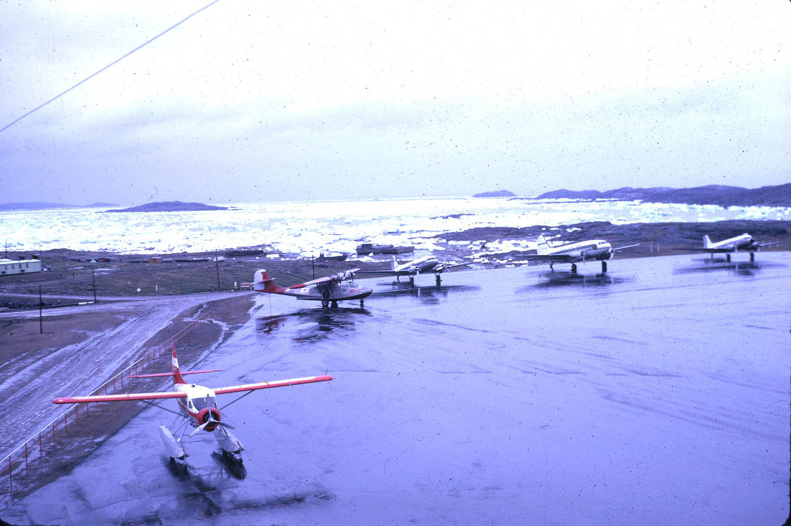 The view from Frobisher Tower, August 1962. No, not a misprint, August 1962! Check out the aircraft types on the ramp, Otter, Canso, C-47, C-46 and C-47. |
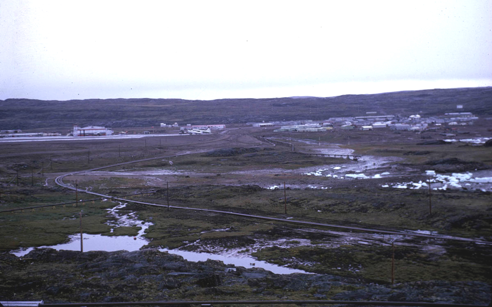

Frobisher airport and control tower are in the distance on the left in this photo. The picture on the right show the rather stark landscape surrounding the small community |
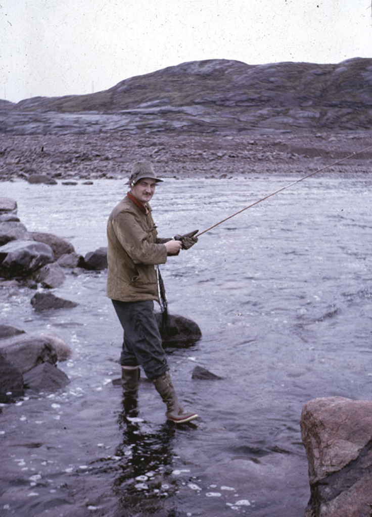
1962(R) Correction. The intrepid fisherman in this photo is not Ron Hay, it's Ivan Delong - but there is a connection! In Ron Hay's own words: ...Ken Vryenhoek who pointed out the error. The fellow fishing in Frobisher is not me. It's Ivan Delong, a chap who trained on Harvards with me in Gimli Manitoba. After he finished his short  service commission he got a job with Maritime Central Airways flying that C46 that we could see from Frob tower. I bummed a ride with Ivan up to Frobisher and back to YYR. (ed. note, I like this story and the picture was taken near Frobisher. service commission he got a job with Maritime Central Airways flying that C46 that we could see from Frob tower. I bummed a ride with Ivan up to Frobisher and back to YYR. (ed. note, I like this story and the picture was taken near Frobisher. On the right, the "real" Ron Hay in 1963 in Goose Bay. He lost the Winter Festival beard growing competition, he couldn't come close to Bob Wonacott when it came to growing hair. |

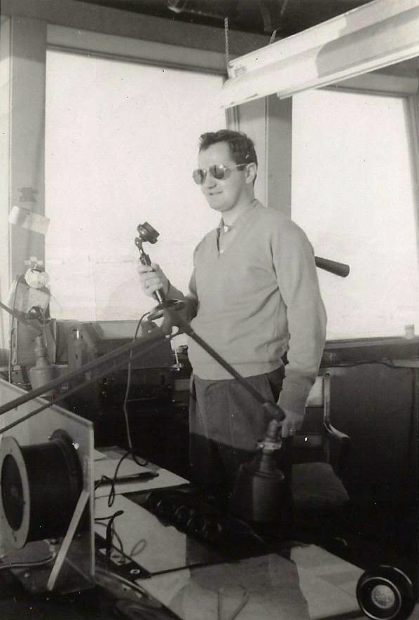
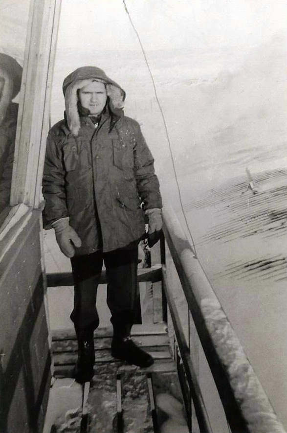
December, 1957: Eric Staples standing outside of Frobisher Tower. |
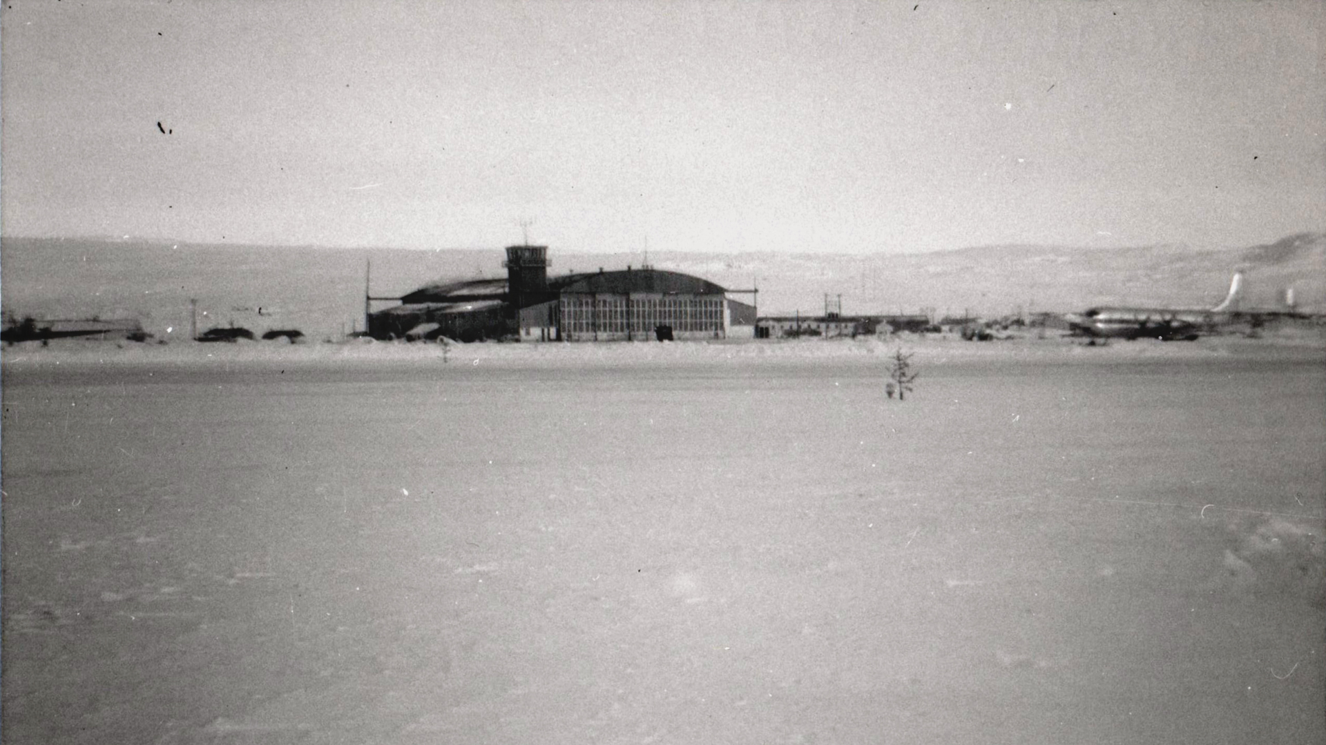
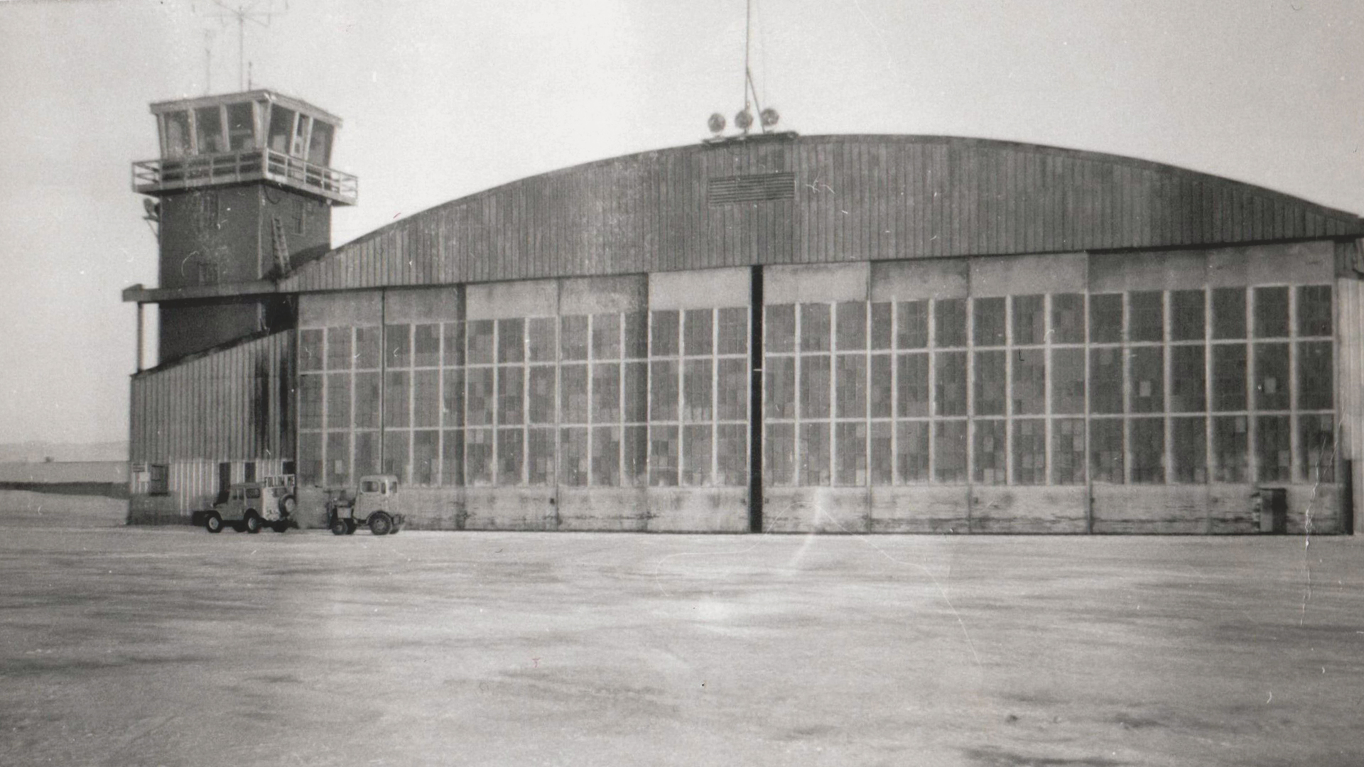 January 1958: Frobisher Bay airport. Note the KC-97 on the right. Frobisher Bay control tower and main hangar. |
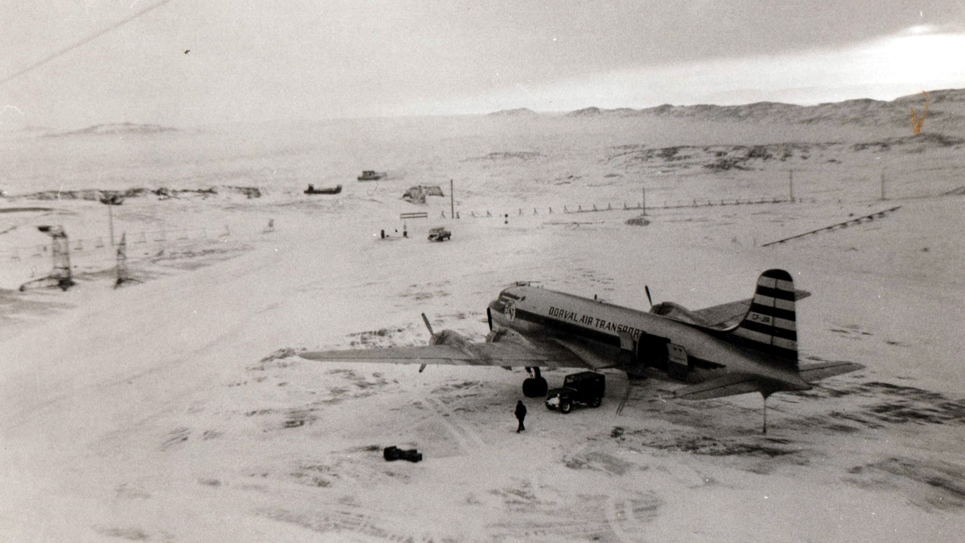
 January 1958: Dorval Air Transport DC-4 parked on apron Looking at the runway - cold out there! |
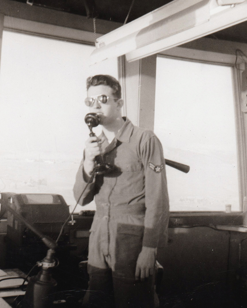
 January 1958: Controller (military?) in Frobisher Bay tower |
|
Photos and text courtesy Brenda Staples |
 ✦✦✦ Goose Bay ✦✦✦
 |
CFB Goose Bay traces its roots to the Second World War. Canada built several strategic bases in Newfoundland and Labrador, for the protection of North America from attack on its northeastern flank, and in the case of Goose Bay, to act as a staging point in the north-eastern air route across the Atlantic via Greenland, Iceland, and the British Isles. In the summer of 1941, an RCAF survey team determined a suitable location for an air base. Construction soon followed the initial surveys and three (3) 7,000 foot runways were opened on Nov 16, 1941. The first military aircraft landed on Dec 9. At this time, over 3,000 RCAF personnel were assigned to RCAF Station Goose Bay. |
|
|
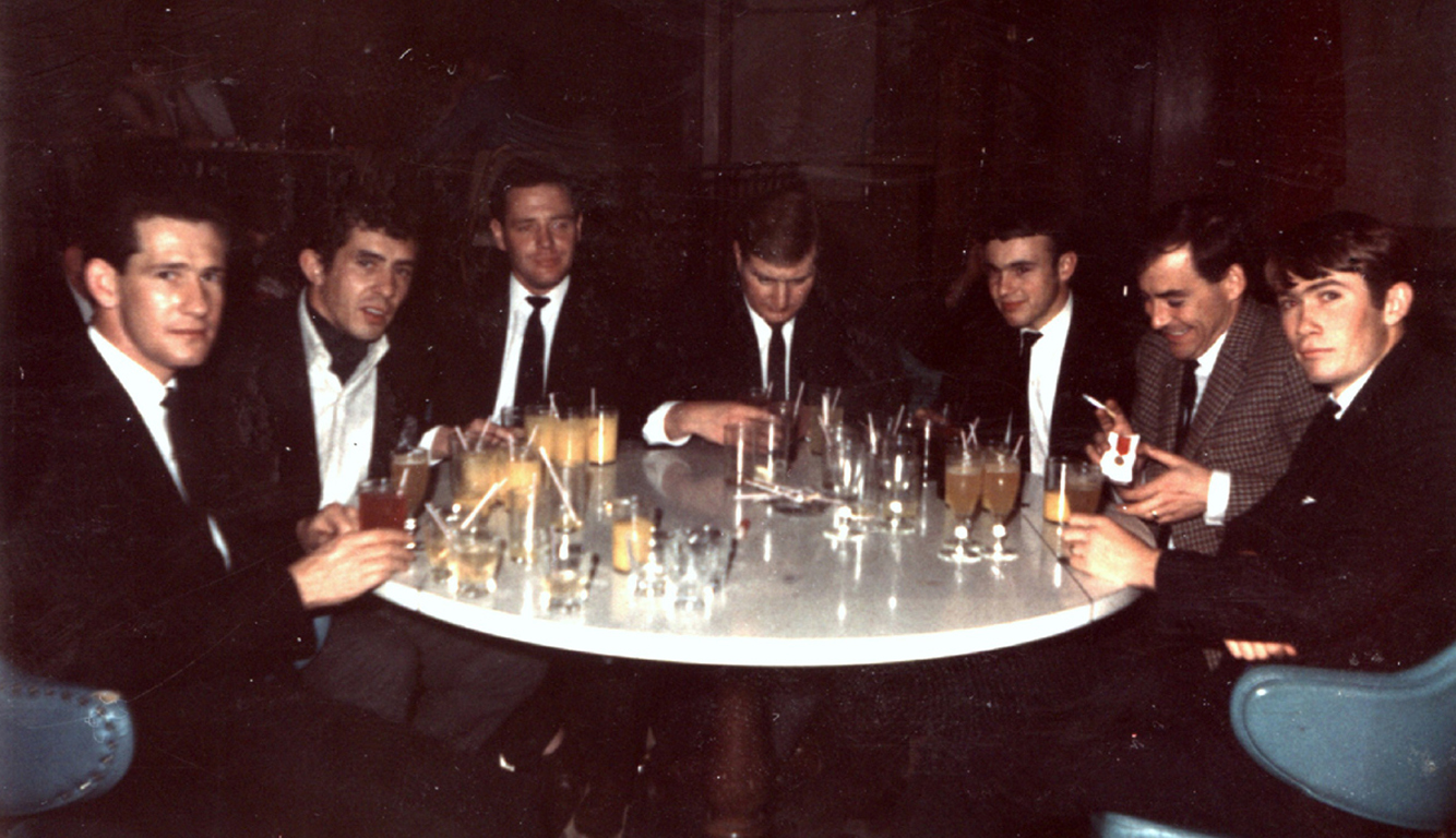
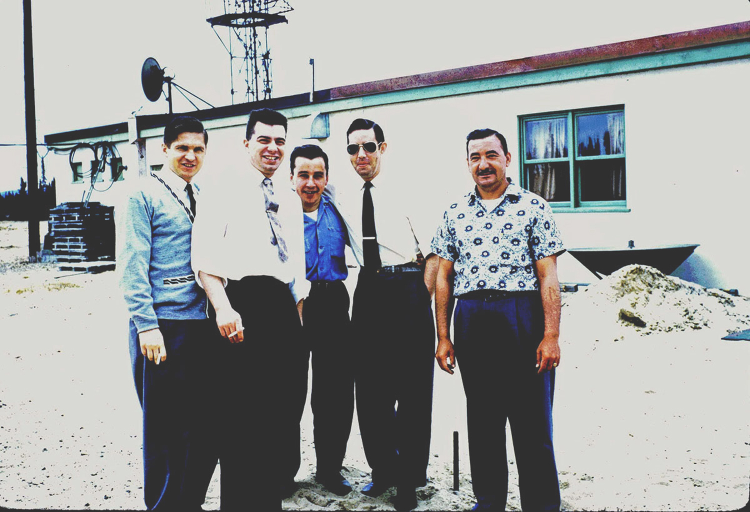 Summer 1961 L to R: Joe Kovalenko (YC), Ken Vryenhoek (VR), Tony "Tweet" Blake, Jim Henderson (YC), George Allard (UL). |
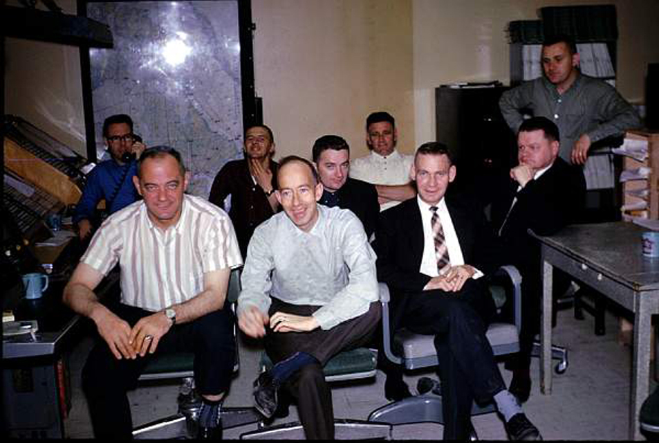
 Summer 1963, a Goose Bay ATC staff picture. Ron Hay provides the names: front row - L to R: Phil Bergenham (VR), Joe Kovalenko (EG), Elmer Tomecek (WG), Eric Staples, supervisor (QM), Len Kalicheck (EG), "Doc" Elliot (UL) back row, left to right; our secretary Alberta Vautour, George Machum (QM) Chief, Irv Simmons, supervisor (QX), Sid Bowers (QM), Ken Vryenhoek (VR) and Henry Boduc (UL). |
 1964 front row, L to R: Moe Cantwell (OW), Bryce Hart(VR), Sandy Sanderson (UL), Sid Bowers (QM) back row, L to R: Doug Ellis (YC), Hori Hale (QX or QM), Bob Wonnacott (WG), George Champagne (UL), John Mason (OW) |
|
|
 1961: US F-102 "Delta Dagger" taking off in the distance. |
1963: Barney Sharp (VR) and his sons standing in front of a Canadian Air Force CC-66 (CL-44) Yukon. |
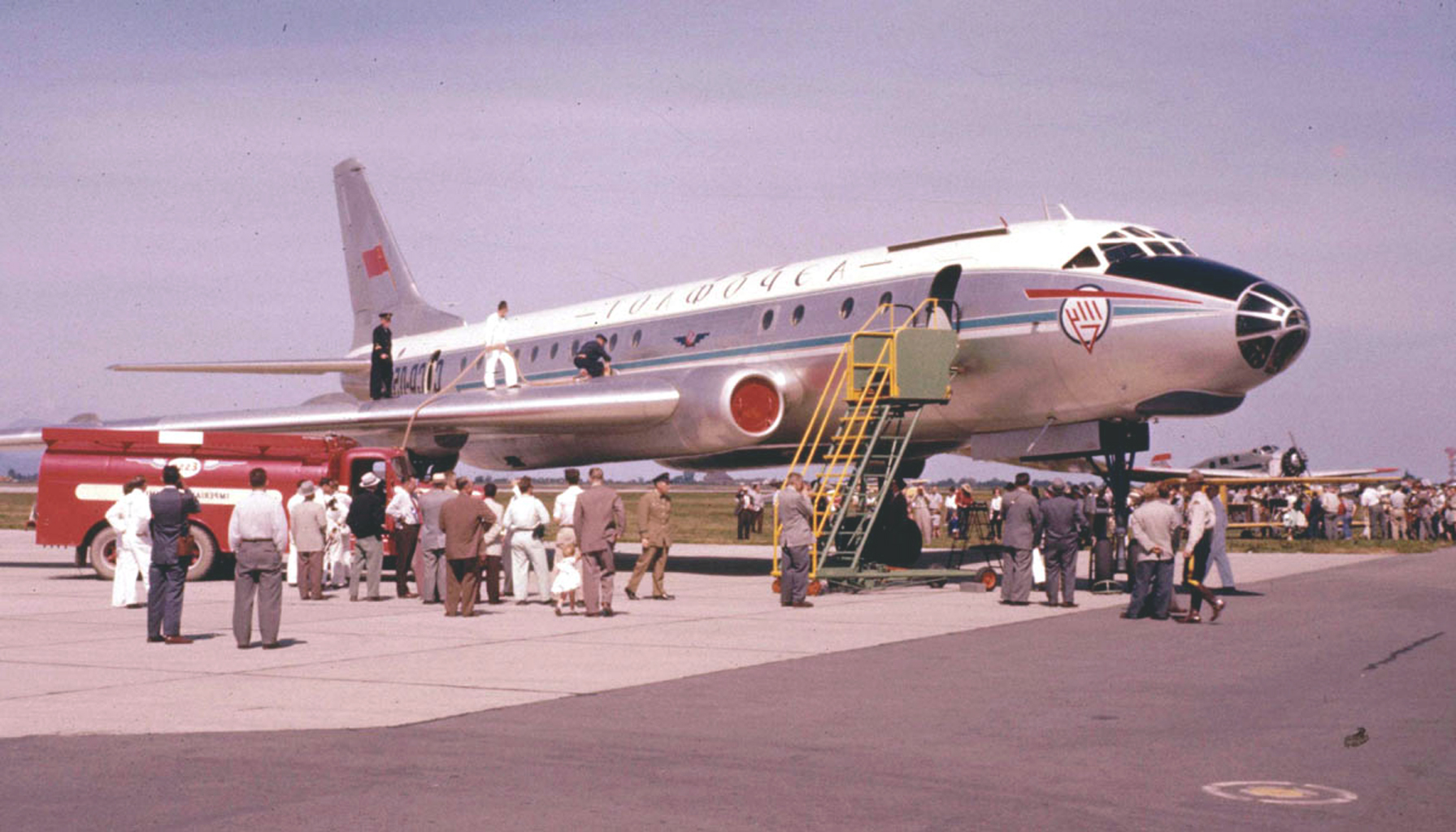
1961: Russian Tupolev at Goose enroute to Cuba in 1961. Must have been an interesting experience. |
|
|
|
Goose Bay Labrador, August 19, 1957, before departure on refuelling mission over the Gulf of St. Lawrence. 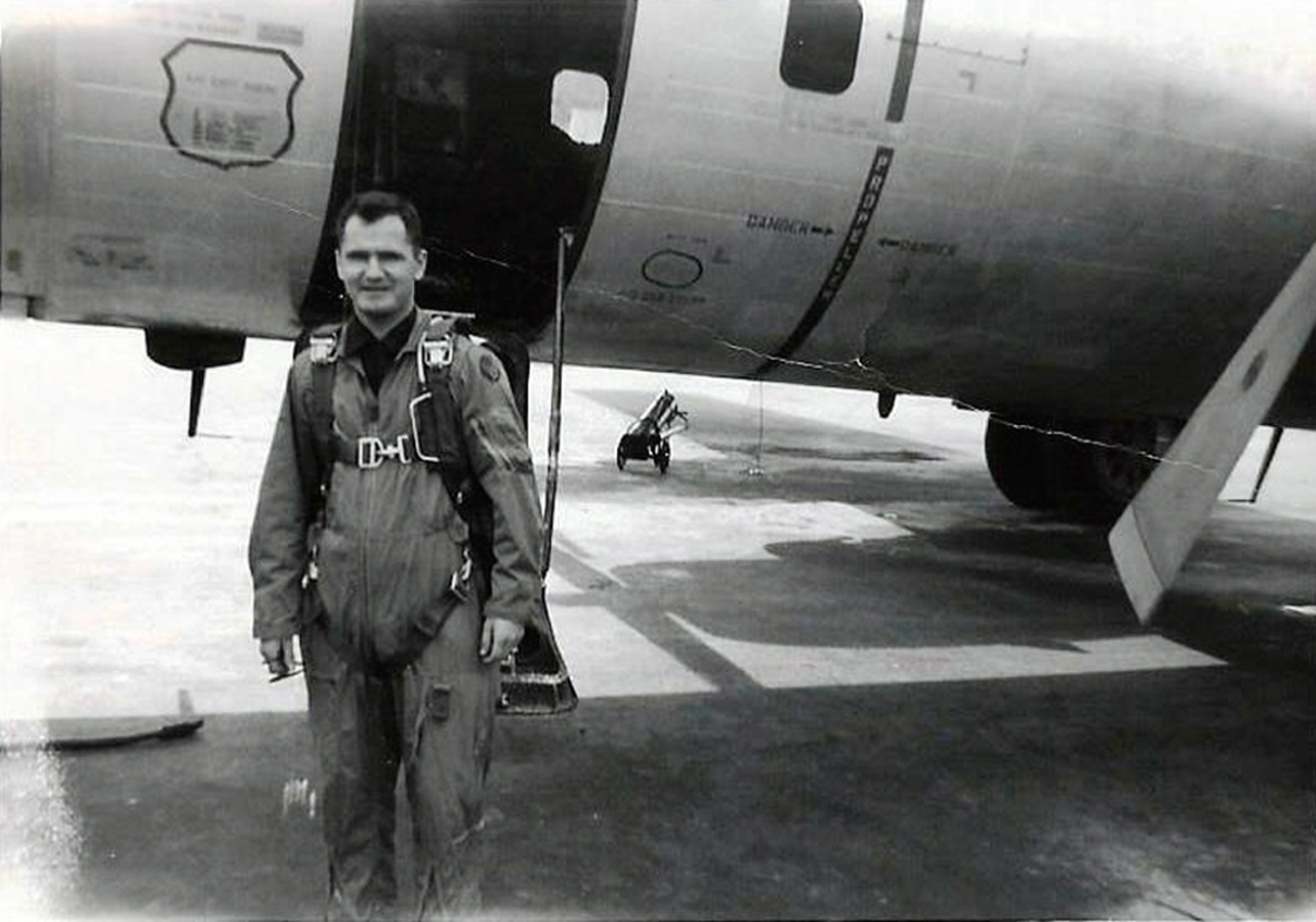 Eric Staples ATC, gets an opportunity to fly in a KC-97 tanker. |
The crew including aircraft commander Captain Adams USAF and Captain Wellms USAF Aircraft used was a KC-97 tanker, |
|
|
|
|
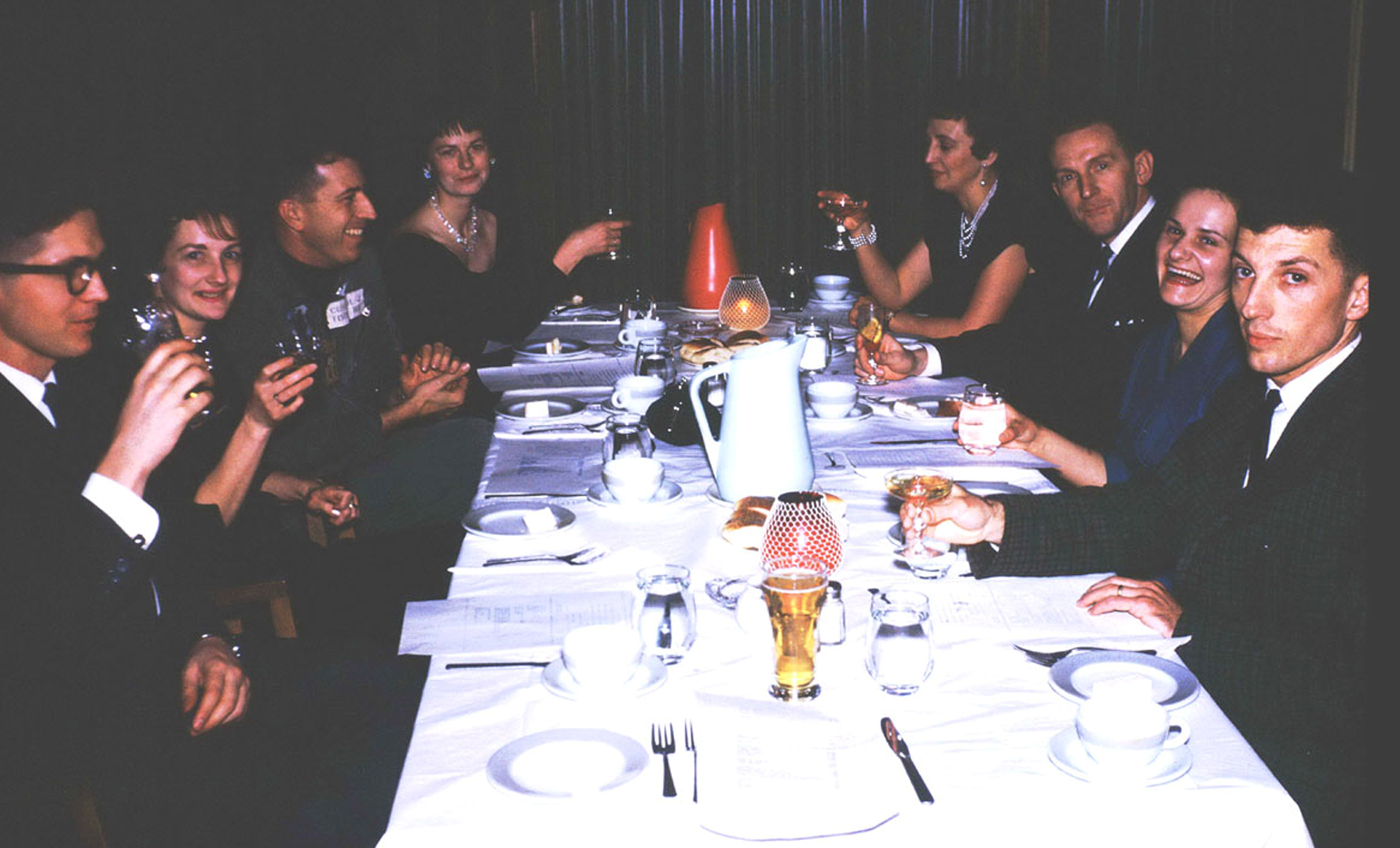
 196?: Iain McKeracher, former RAF aircrew, sent this picture taken in 196? at the American Club. That's Ray Landry 2nd from left and Iain is 3rd from left. |
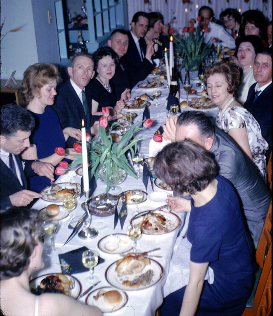 1964: A progressive dinner party which featured a separate course in each home. |
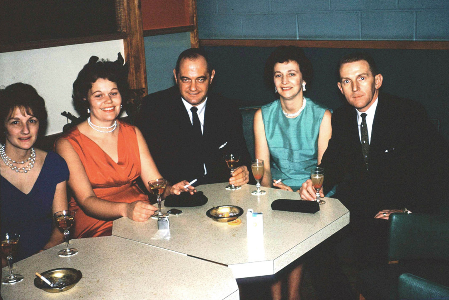 
1962: L to R at the Officer's Mess; Joan Hay, Helen and Moe Cantwell, Elaine and Al Ranger. 1962: Another party at the USAF Officer's Club. |
|
|
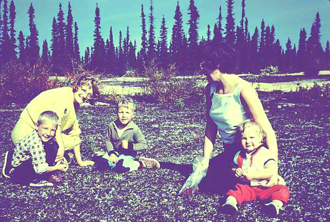
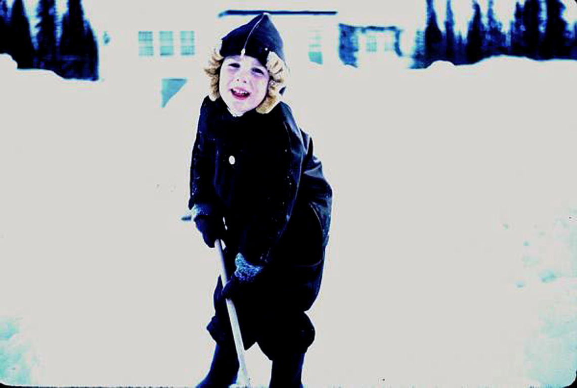
1961: Hays and Conways picking cranberries near PMQs. 1961: Jeffrey Hay liked to help shovel our walkway. |
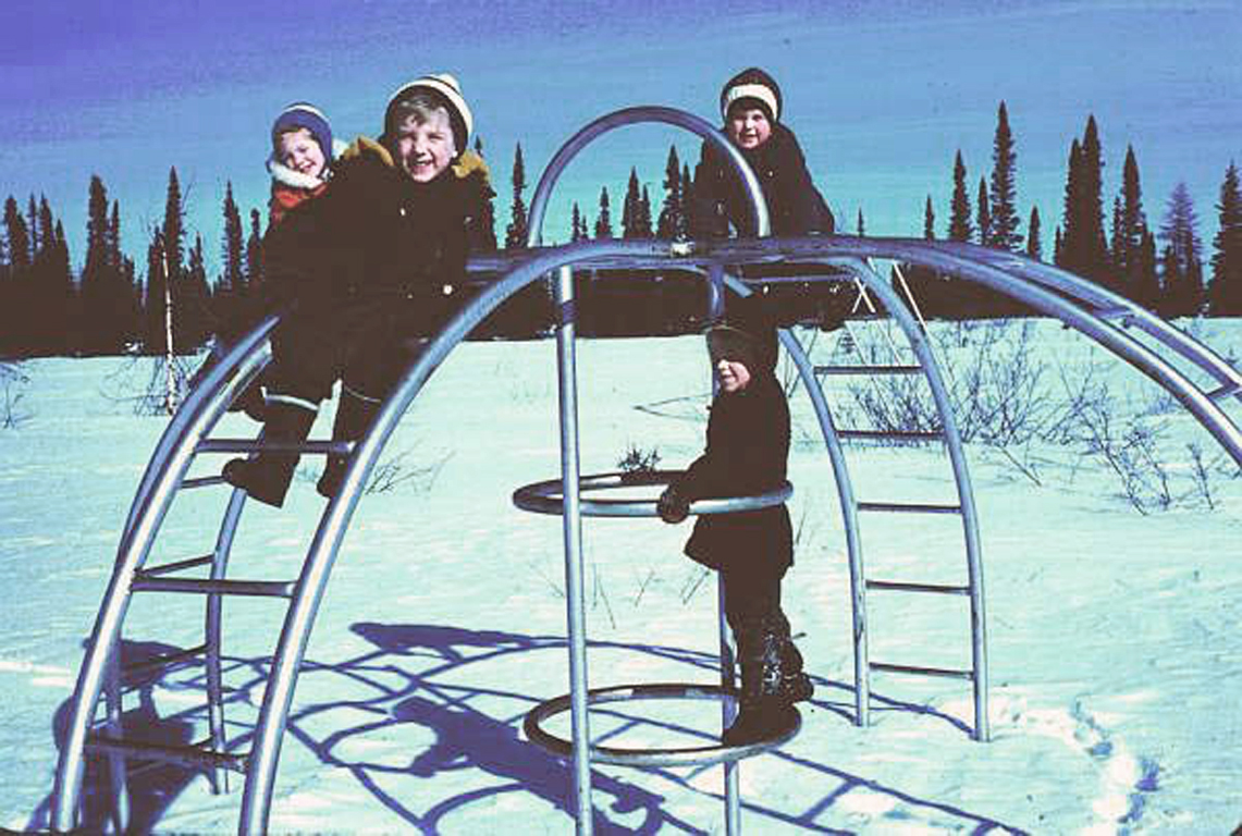
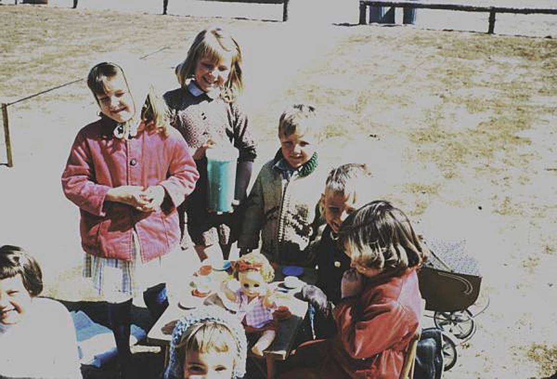
1961: Playground in B area of DOT housing. 1961: Kids birthday parties were popular. |
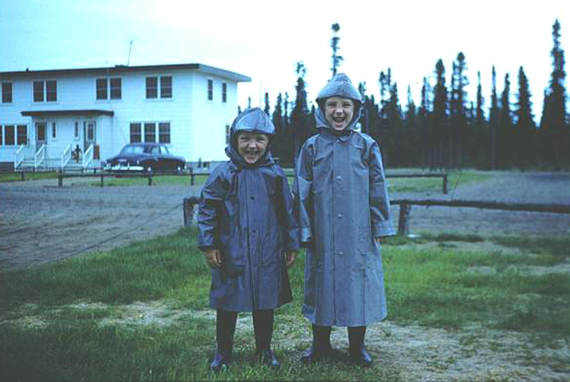
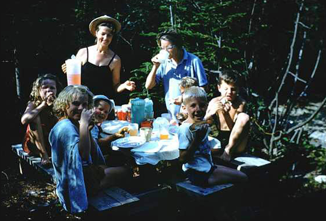
1962: The Hay kids - July in Goose Bay. 1962: The Hays family picnicing with the Pike family from Gander. |

1963: Growing up in the early '60s and in a more remote area was completely different than today. Kids were free to play and wander. Just make sure you're bundled up in the winter and home for supper in winter or summer - the only seasons in Labrador! |
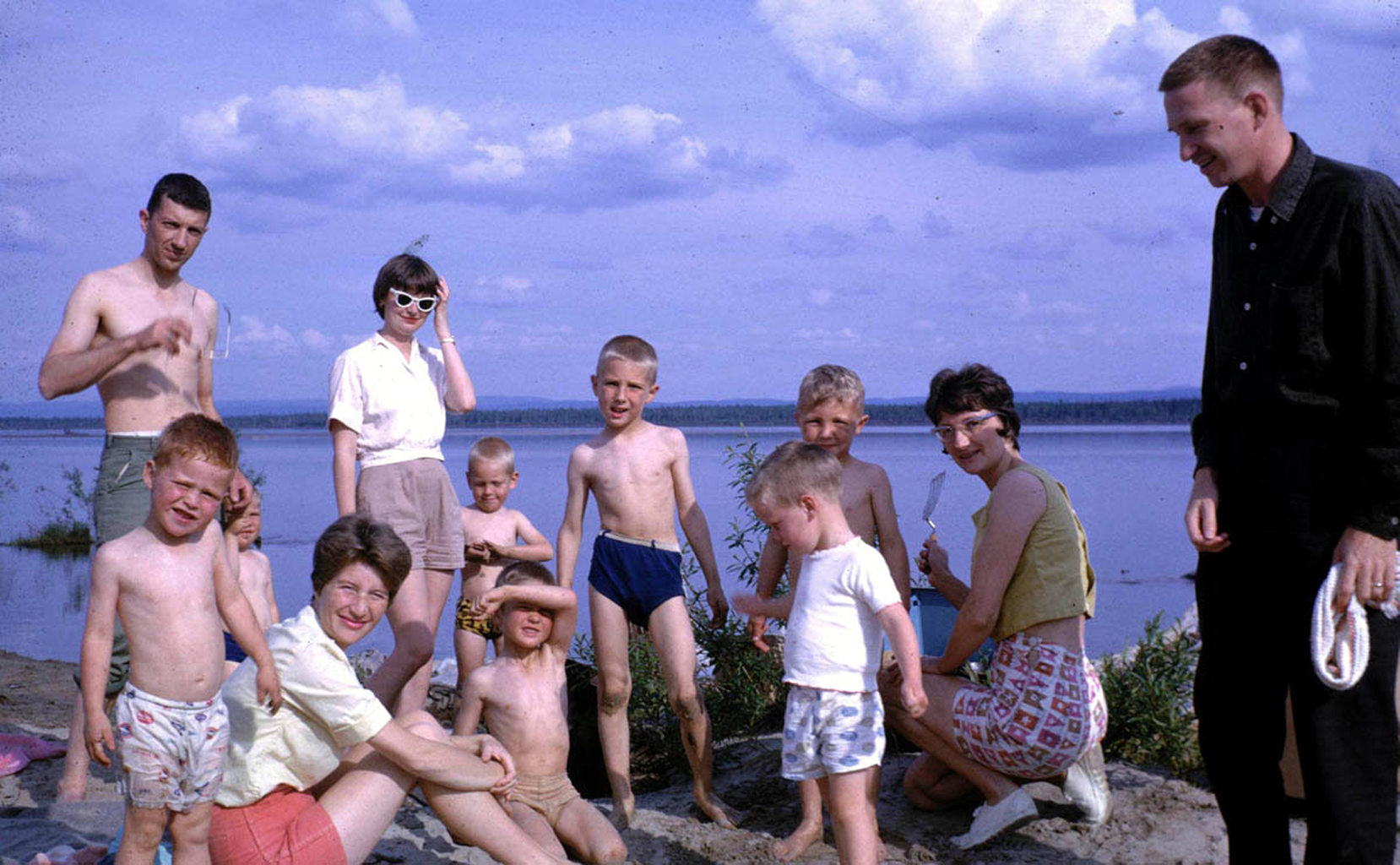 1963: Fun at the lake. The adults are: on the right; Jim Paxton, his wife Pat is seated, on the left; Barney Sharp and his wife in the sunglasses, flipping the burgers is Joan Hay. |
|
|
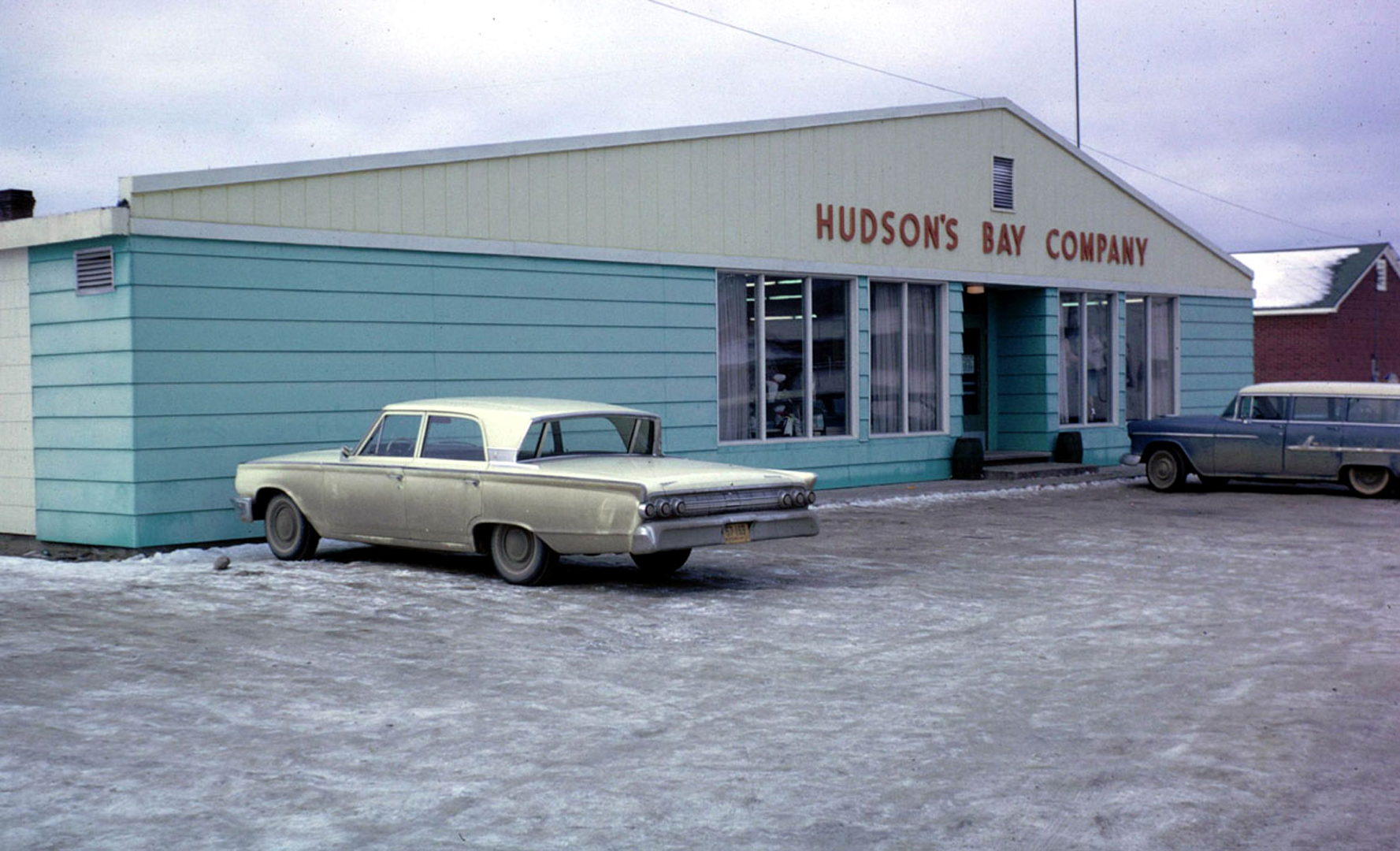 1963; Every community in Canada's farflung "North" had a Bay store. They were as Canadian as Tim Horton's coffee shops are today. But although in the larger cities the Bay has fallen behind to larger retailers and box stores, smaller stores still abound. And for those of us who enjoy the ironies of history, the "Bay Northern Stores" have been replaced by the "Northwest Company"... |
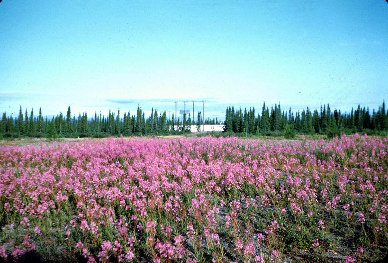
Fireweed in the all too brief summer. |
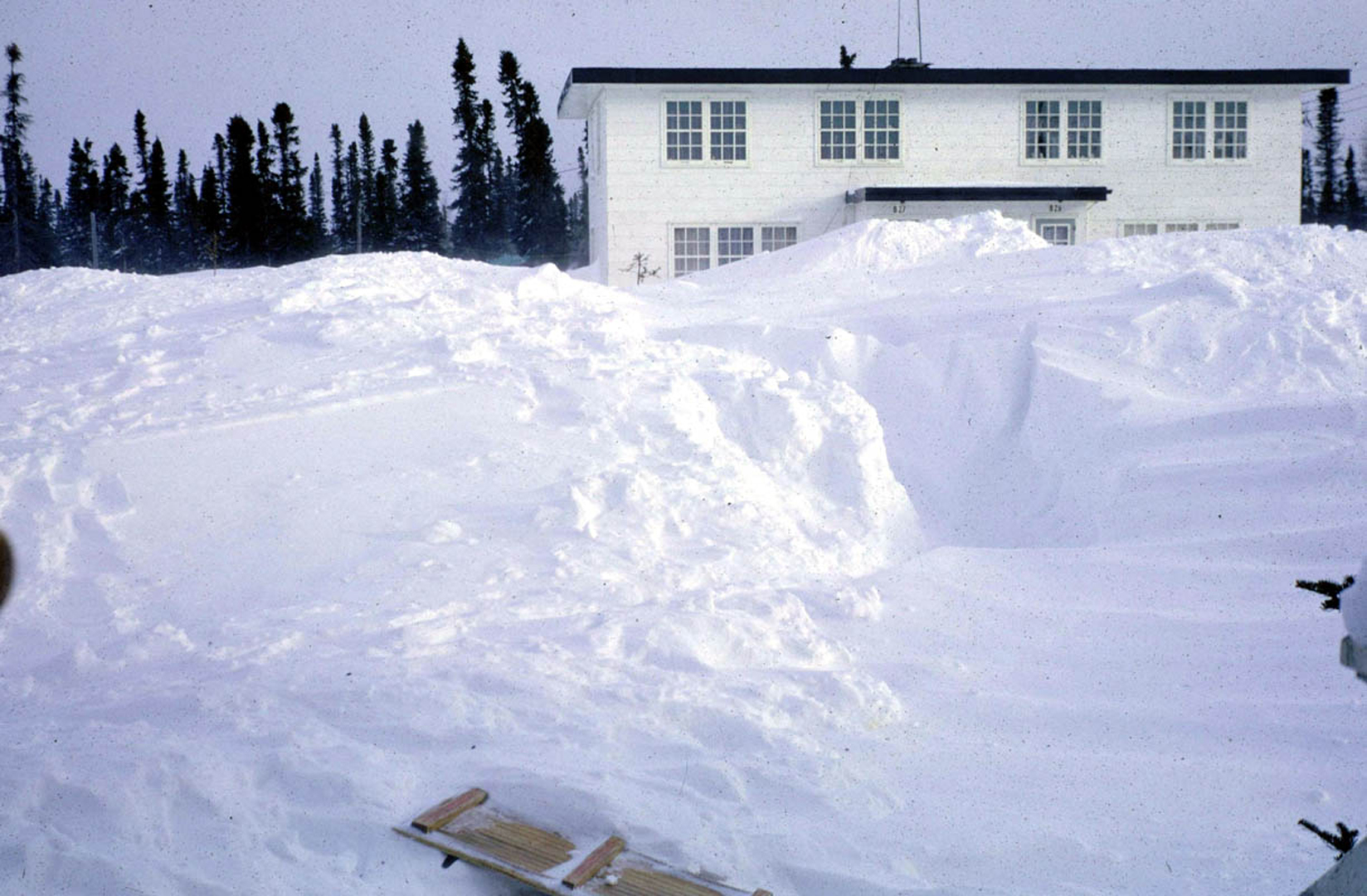
Ah winter, the other season. |
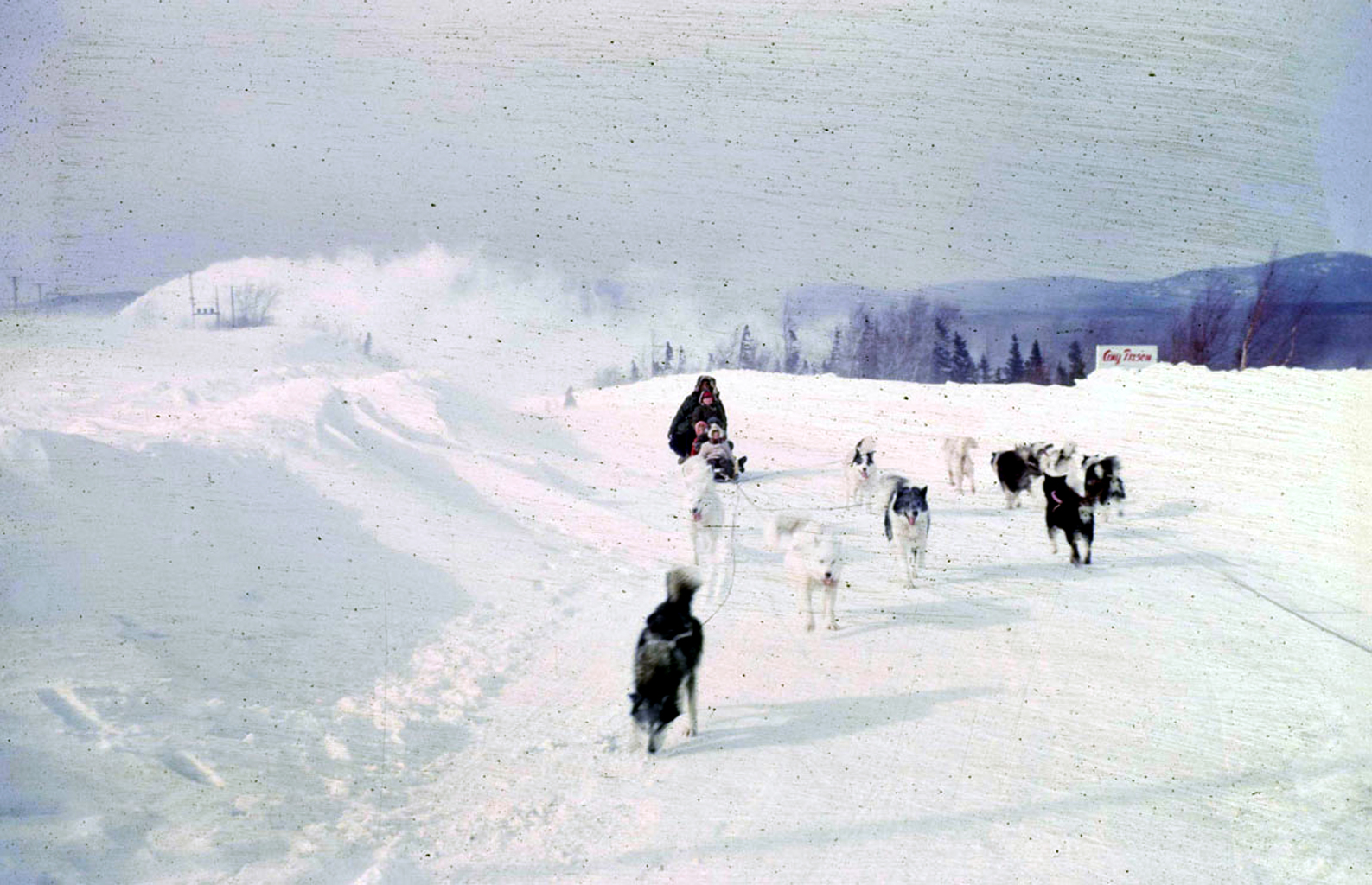
A scene you won't see on Dundas, St.Catherine, Burrard, or even Portage Avenue for that matter. Most winters some of the locals arranged rides on a dog sled and team for the kids and it was immensely popular - I bet!!! |
✦✦✦ The North ✦✦✦ |
|
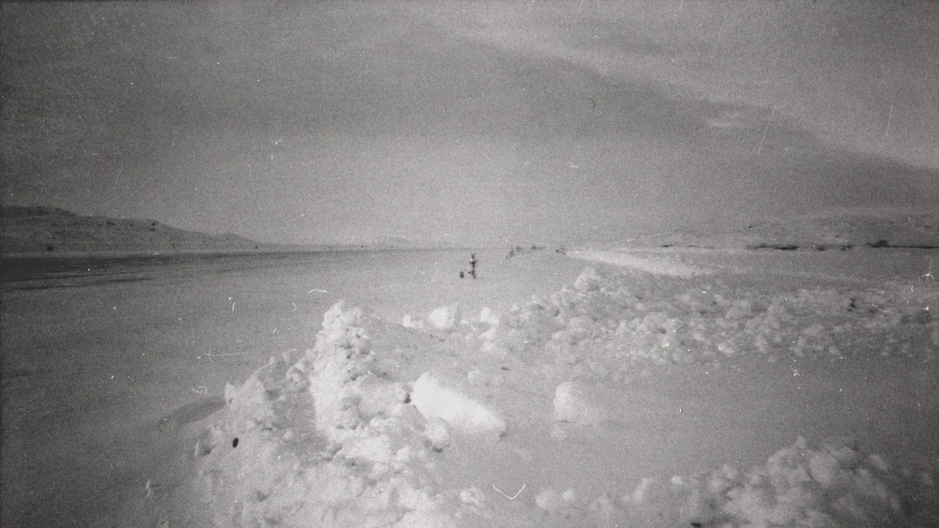
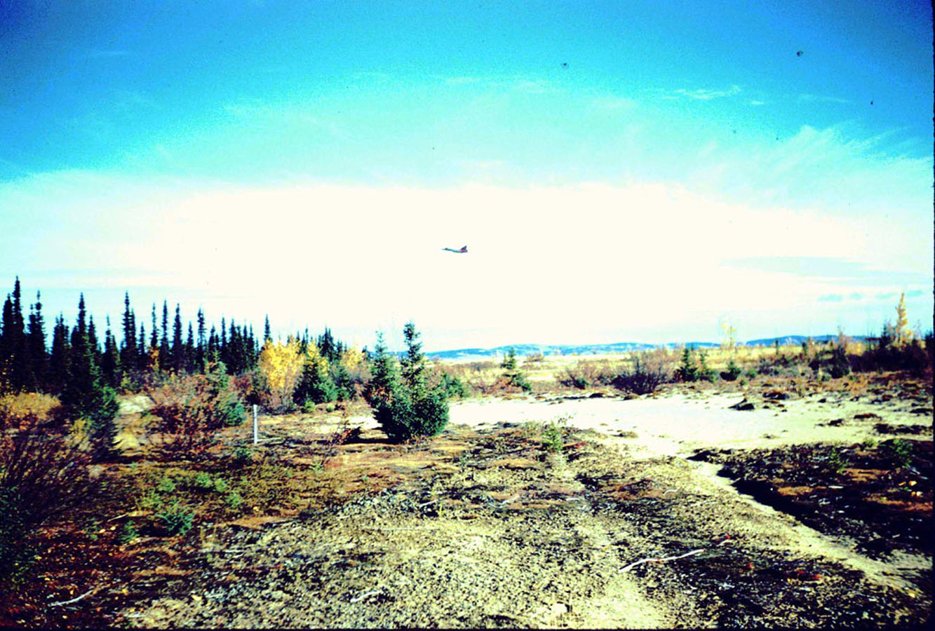
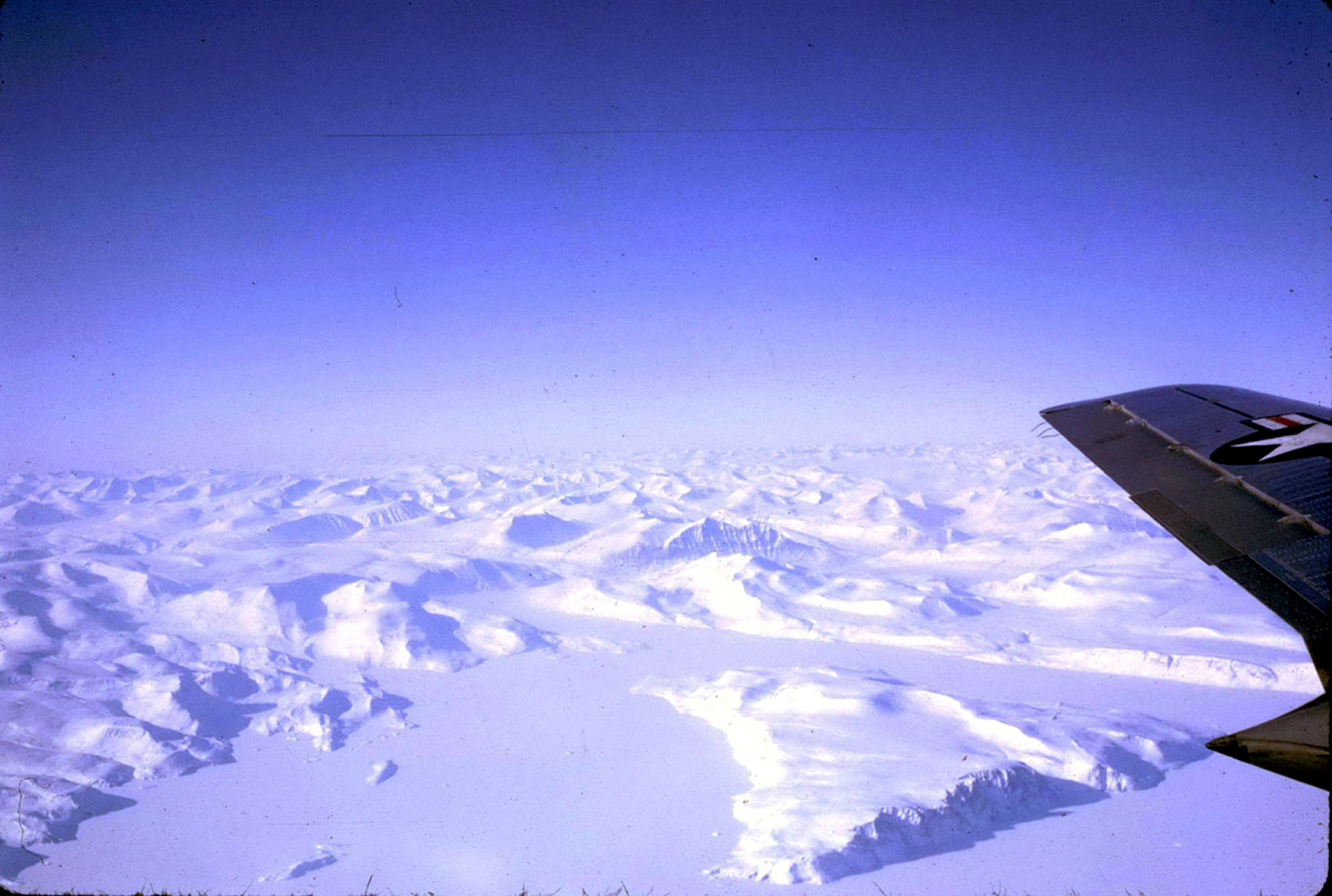 1964: From Ron Hay: I took a trip (from Goose Bay) on a KC-97 to Thule Airforce Base(BGTL) and snapped a shot of Baffin Island from 17,000 feet.. |
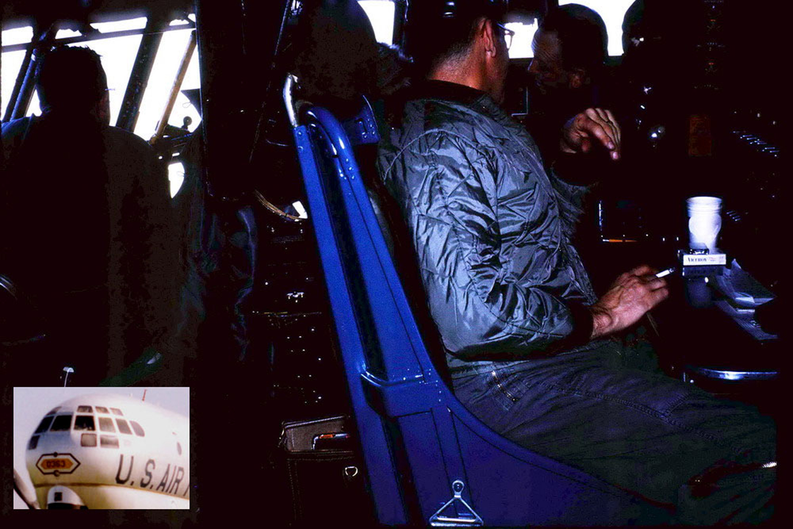 From the inside of the KC-97. Notice the crew configuration and as this aircraft was pressurized, the crew could smoke.. |
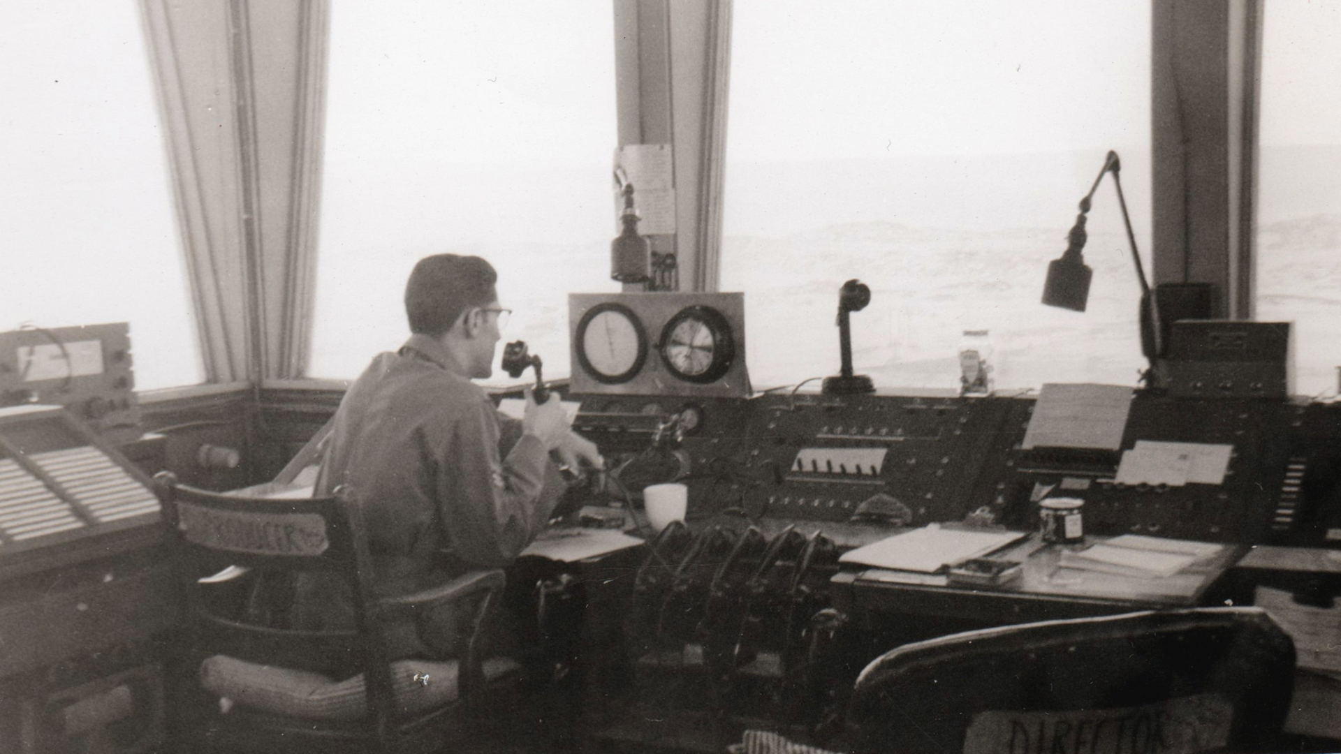
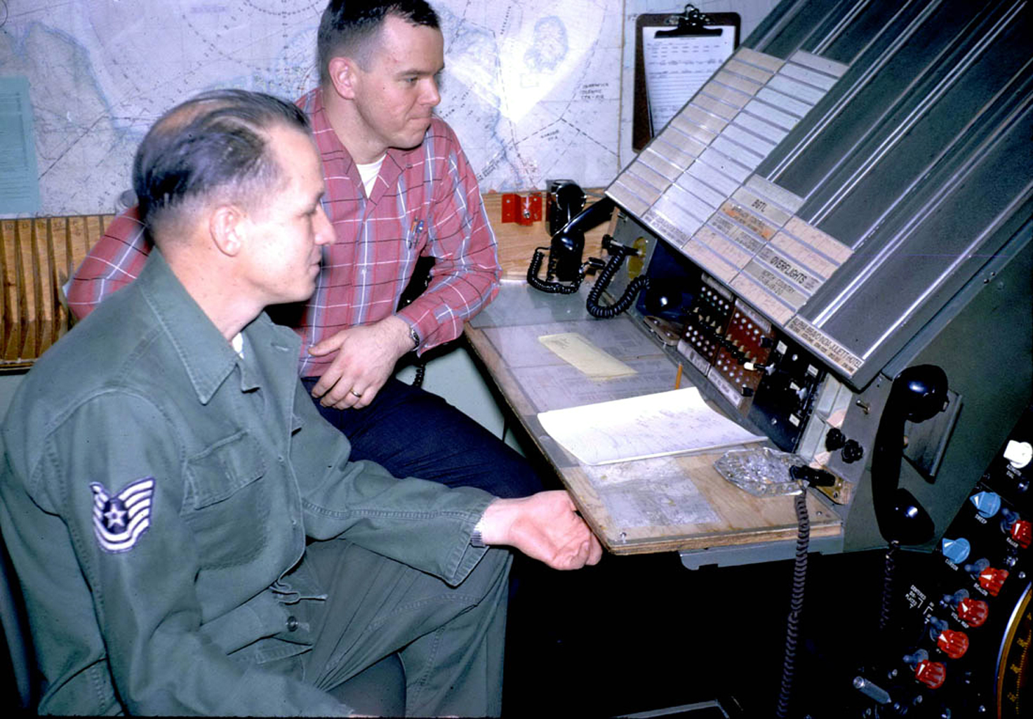 1964: A picture of two fellows manning the approach control facility at Thule Iceland. from Ron Hay: This was in March 1964 and Thule only had a few hours of daylight. On the way up as we passed Saglek I could see the radome on the hilltop but to my surprise I also saw that there were four or five C119s disgorging paratroopers. The sea was frozen for about 20 miles out from the coast and these guys were landing on the ice. I could hardly believe it. I found out later that they were VanDoos and a few months later were posted to Cyprus. Winter training and a tropical posting... |

 C a n a d a ' s N o r t h